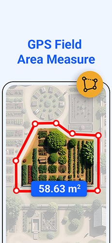
GPS Field Area Measure is a smart tool for measuring areas on the map
Explore Features
About App
GPS Field Area Measure is useful to calculate GPS area or distance with accuracy.
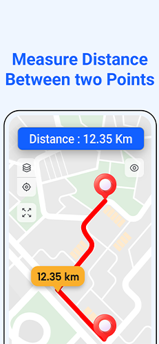
Measure distance between two location
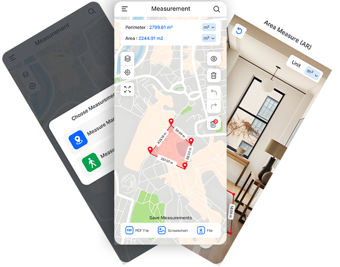
Measure distance or area by walking and app automatically add markers.
App will calculate Distance / Area in Meters, Kilometers, Miles, Feets etc...
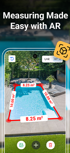
Measure distance or area in real time using AR and your phone's camera.

App Features
Awesome Features

Measure Distance
Measure distance between two location using map or measure specific area adding simple marker

Walk & Measure
Measure distance or area by walking and app will automatically add markers on that location points

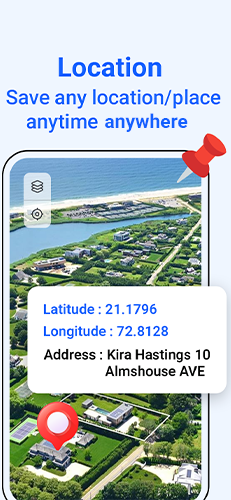
Save Coordinates
Save specific coordinates of Latitude & longitudes or save calculated area/distance and view directly on map in future.

Unit Settings
App will calculate Distance / Area in Meters, Kilometers, Miles, Feets and Yards. You can change unit from settings.

Import KML File
Import KML files to get your measured data. Generate detailed reports for further analysis or collaboration with team members.

Save Screenshots
Save screenshots of your measured distance or area, which you can use later when you needed it
Download
Download The Latest Version Of Our App
Need to measure the area of your land, field, or yard? Want to calculate distances, perimeters, or areas using GPS? Introducing GPS Field Area Measure, the most precise and reliable GPS-based app designed for measuring land areas and distances effortlessly.